CENTRE FOR JOINT WARFARE STUDIES

An Autonomous Think Tank Promoting Integration and Jointness as a Synergistic Enabler of National Power, Providing Policy Alternatives Through Research and Debate
Latest Updates

CENTRE FOR JOINT WARFARE STUDIES

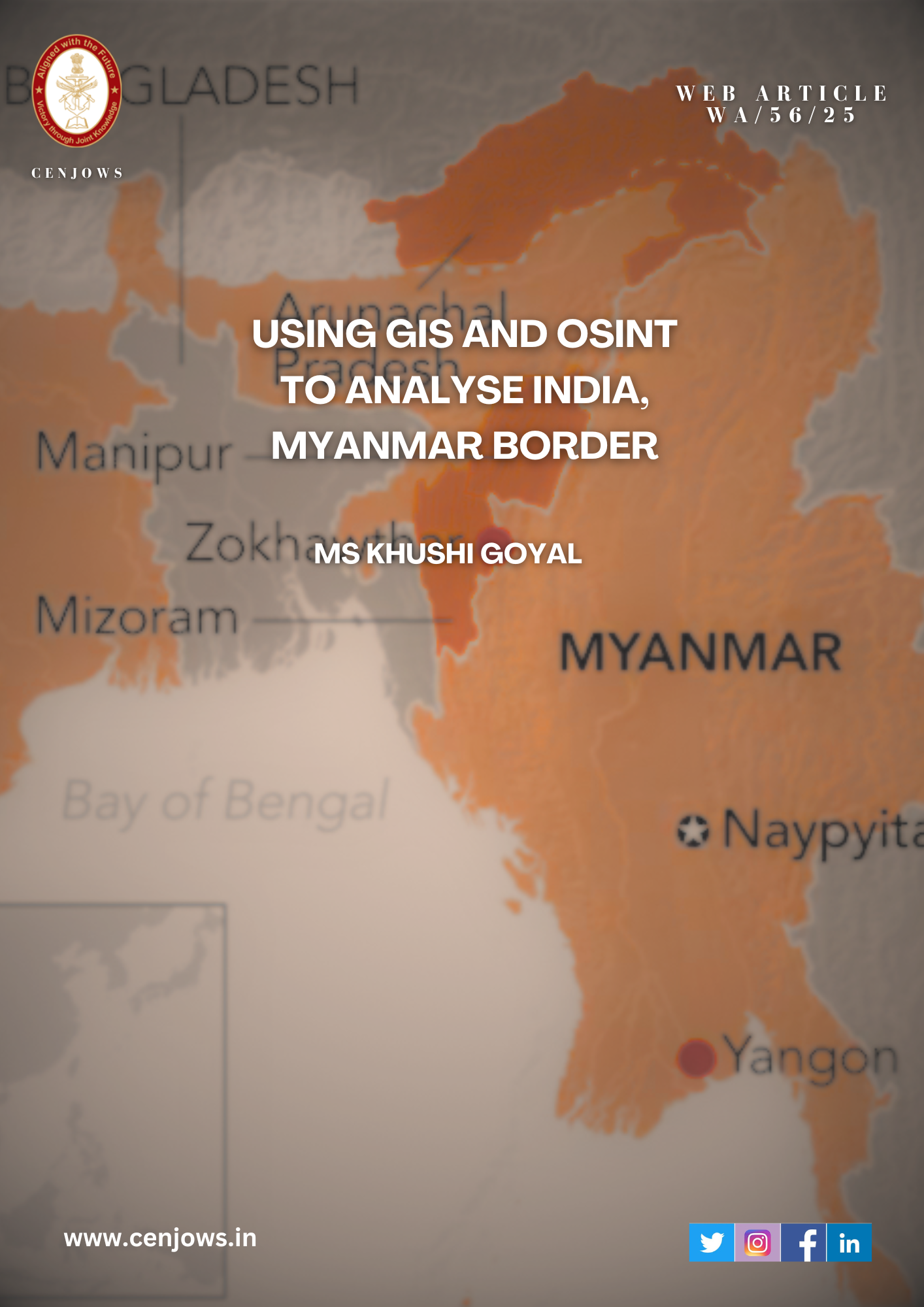
Using GIS and OSINT to analyse India, Myanmar Border

Introduction

The India–Myanmar border poses certain challenges to boundary security. It passes through difficult terrain, diverse ethnic communities, and resilient insurgent networks. Recent decisions taken by the Indian government, including termination of the Free Movement Regime (FMR) and plans for a full border fence, reflect this. This article includes GIS analysis and open-source information to analyse terrain and geopolitical factors affecting movement and security.

Borders are lived frontiers. They are socially open, geographically challenging, and strategically contested. This is evident with the 1,643-kilometre-long India-Myanmar border stretching through four Indian states: Arunachal Pradesh, Nagaland, Manipur, and Mizoram. It is characterised by dense forests and terrain, cultural networks and ethno-linguistic links that are not defined by state boundaries. India is connected, via a 22-kilometre narrow path called the Siliguri Corridor, located between Nepal and Bangladesh. These factors create a broadly defined geopolitical zone where insurgency, cross-border trafficking, refugee flows, and external actors are involved.[i]

For India, the border has become a security challenge in every sense. It includes regular military risks and insurgent activities but also issues like drugs, illegal logging, migration, and even ecological stress. China’s increasing presence in Myanmar adds to this complexity. Managing it means old-school military approaches need additional support. New methods like open-source reporting and GIS mapping can contribute to understand where problems arise and how to stop them pre-emptively.

Historical and Strategic Context

This border was drawn during colonial times and did not consider local communities. The Free Movement Regime allowed residents within 16 kilometres of the border to travel with minimal restrictions. This policy recognised their ethnic and cultural ties. However, reports of insurgent activities, arms trafficking, and drug smuggling have led the Indian government to end this provision. Although there has been no official announcement yet, new rules will reduce the visa travel corridor to 10 kilometres. Residents from the Myanmar border region entering India will also need day passes issued by the Indian military. 2This change was pushed due to instability in Myanmar since the regime change in 2021. The situation has led to rise in the number of refugees and boosted illegal economies. 3

Due to geographical factors, the border remains porous. The lack of strict control along this border comes from three main factors: the imposed border, the Free Movement Regime, and difficult terrain. The border cuts through various social, cultural, and economic areas in the region. While it follows traditional lines of watersheds and rivers, its marking has divided several communities. The Nagas, Kukis, Mizos, Chins, and other tribes are split by the international border. After independence, insurgents used ethnic ties to create safe havens across Myanmar. They have established bases, in Chin and Sagaing. These areas act as safe spaces to rest, regroup, train, plan future actions, and evade Indian security forces. The limited control of the Tatmadaw over remote areas have allowed these sanctuaries to persist, despite India’s tries.4

The border is vital for two strategic regional initiatives. It serves as a gateway to the east, given the Act East policy and reduces reliance on the narrow Siliguri Corridor. India is undertaking infrastructure projects like India-Myanmar-Thailand Highway and the Kaladan Multimodal Transit Transport Project support this. It will make Moreh’s a trans-shipment hub and increase Mizoram’s connectivity. 5 They also counter balance China’s growing infrastructure influence through the China-Myanmar Economic Corridor. However, threats from insurgents expose possible vulnerabilities.

The porous border between Manipur and Tamu district in Myanmar has about 80 unofficial crossing points. Here, Moreh acts as a transportation hub not merely a smuggling entry point. The limited road network in Manipur means that few towns can support this illegal economy as effectively as Moreh. It also has road access to Imphal helping move smuggled items deeper.6

These routes are close to moderate slopes and river valleys, where seizures and illegal crossings occur. This creates a dual-use problem. Routes meant to promote legal trade and regional cooperation are also causing harm. This is where open-source intelligence and terrain analysis become important. Open-source reporting provides detailed information on seizures, delays, and insurgent activities along these routes. GIS data includes maps of slopes, rivers, and key points. When combined, they show new highways acting as smuggling paths or conflict zones. To confirm this terrain-based assessment, seizure locations and security incidents were matched against slope and waterway conditions. Areas like Champhai, Seling, and Moreh showed overlaps between suitable movement terrain and actions by Indian security forces.

Recent statements support these patterns. In August 2025, Lt Gen Vikas Lakhera (Director General, Assam Rifles) said that since December 2024, there have been records of over 42,000 illegal entries into India from Myanmar. Security forces also captured an active member of PREPAK from Imphal East. This highlights the connection between illegal movement and insurgent activities. It allows identification of weaknesses and a proactive response rather than reacting to new illegal activities later. 7

Contemporary Security Challenges

Insurgency is a major security concern. Groups like the NSCN (Khaplang) and the People’s Liberation Army (PLA) from Manipur have long used the poorly governed Sagaing and Chin regions of Myanmar for training and logistics. There have been collaboration between Indian and Myanmar forces in counterinsurgency. These efforts have shown some success. However, the regime change in Myanmar in February 2021 has disrupted this partnership. This shift has led to renewed militant activity. According to ACLED, over 2,600 new non-state actors have appeared in Myanmar’s conflict since April 2021. This accounts for 21% of all documented non-state armed groups worldwide. The new military government has also led to more refugees entering Mizoram and Manipur. Many members of these groups have ethnic ties to local communities, but their presence has strained resources and increased tensions. 8

The border is shaped by both geopolitics and crime. The India-Myanmar border is part of the “Golden Triangle.” It is one of the largest opium-producing areas in the world. Trafficking routes run through Manipur and Mizoram into mainland India. Drug trafficking supports insurgent groups and ties the borders to global organised crime. The use of synthetic drugs like methamphetamine has surged. 9

This rise in drug trafficking across the border poses serious threat to both regional security and public health. Easy access to heroin and other synthetic drugs has led to rise in high addiction rates among the local population. It has led to the spread of HIV/AIDS as many users share needles. Drug profits are in turn, used to back insurgencies posing significant risks to national security. Money from these illegal activities finances insurgent operations and local patronage systems, create reinforcing cycles of insecurity that are hard to break.

In addition to insurgency and crime, ecological fragility is another security challenge that often gets overlooked. Deforestation both contributes to and results from the drug economy. Illegal logging and traditional farming practices make forest loss worse. Forest cover fell from 58% in 1990 to 44% in 2015. The Forest Resource Assessment reveals that national forest cover dropped from 58% in 1990 to 42% in 2020, with an annual change of 1.05%. Myanmar ranked 7th globally for annual net forest loss between 2010 and 2020. Studies show that Myanmar lost about 0.87% of its forests each year from 1988 to 2017, with the Kachin and Sagaing regions, which border India, being the most affected. For India, the militarisation of border ecology has long-term implications. These trends demonstrate how local terrain interacts with broader geopolitical issues, shaping the security landscape. 10

Migration involves more than just humanitarian issues. The massive movement of displaced people from Myanmar since 2021 has created security challenges. While many newcomers have cultural ties to resident communities, their presence raises concerns about resource pressure, insurgent infiltration, and changing demographics. The Indian government’s policy responses reflect a security-focused approach, viewing migration as both a humanitarian issue and a potential source of instability.

Terrain Analysis

Terrain significantly affects movement and influences where people choose to cross borders. The main question is not whether people will cross the border but rather from where they will decide to do it. Factors such as slope, drainage, forest cover, and human infrastructure impact the cost of movement and possible opportunities for concealment.

Slope especially restricts speed and load capacity, making it one of the primary factors we consider. In this study, we categorised slope into three levels: 0–15 degrees, 15–25 degrees, and above 25 degrees. These categories correspond to human mobility. Gentle slopes (0–15 degrees) allow for faster movement with loads. Moderate slopes (15–25 degrees) slow progress. Steep slopes (over 25 degrees) are generally avoided as they significantly slow movement and are dangerous.11 Although they are suitable for small-scaled or concealed movement. Traffickers and migrants weigh speed against concealment. They choose moderate slopes that provide some cover without making travel too difficult.


In QGIS, the slope from a digital elevation model projected in WGS84 / UTM Zone 46N was derived. Slope points based on known seizure locations to examine the terrain conditions associated with illegal activity were generated. Buffer zones within a 1 km radius around these seizures and known trails to see how activity clustered near the border were also created. This analysis showed that many incidents occurred close to the boundary, especially where the slope changes from gentle valley floors to moderate side slopes, creating ideal conditions for discreet crossings.

Seizure data from government and news reports is compared with the slope categories. The slope raster derived from DEM shows average slope of 6.94°, with values ranging from 0.05° to 29.61°. When categorized it shows the dataset is almost evenly split between 0–15° (gentle slopes) and 15–25°+ (moderate to steep slopes). This indicates that movement isn’t limited to flat valleys. Moderate slopes are also usable depending on the purpose and transport method. This suggests traffickers select routes that are accessible but still offer some cover. Steeper areas appear less frequently used but might provide concealment for limited crossings. These findings support field studies in other border regions, showing that traffickers often prefer longer routes to reduce their chances of being detected

When we plotted the seizure and refugee entry points on the slope raster, we found them distributed across both gentle and moderate slope zones. This pattern suggests that while valleys (0–15°) remain important for significant civilian flows, traffickers frequently operate within 15–25° corridors, using moderate slopes to avoid detection before reaching accessible roads in flatter areas. For example, seizures near Champhai and Seling are within these transitional slope areas, which aligns with UNODC reports about hidden hill tracks leading to roads.

Seizure points from government reports (Champhai, Seling, and Moreh) are located in lower slope zones, reinforcing that transport corridors and settlement areas naturally funnel cross-border movement. Champhai and Zokhawthar are key refugee entry points located in valleys below the 15° mark, where moving with loads and groups is manageable. Similarly, seizures along NH-6 at Seling correlate with flatter regions connecting Champhai to Aizawl. This observation reinforces the idea that traffickers avoid ridge terrain and prefer predictable lower-slope routes for vehicle travel.

A 1 km buffer around the seizure points was plotted. A pattern in terrain preferences is evident. In these buffer zones, there are landscapes that include gentle valleys and nearby moderate slopes. While steep ridges (>25°) form the outer boundary. This close proximity provides an explanation to the clustering of activity. Refugees generally prefer crossing through flatter sections in the 0–15° zone. As seen at Champhai and Zokhawthar, there are options for movement and settlement. However, traffickers seem to exploit edge conditions, often navigating through 15–25° terrain. This movement happens within the same buffers before descending into valleys. Using a moderate slope, the terrain allows for concealment while also ensuring that routes remain accessible to highways.

Waterways also influence accessibility. Examining hydrographic data shows that streams and rivers often intersect potential routes. These water bodies act as natural barriers during the monsoon and as navigation aids in drier months. When seizure points are plotted against hydrological features, there is a clear pattern. Valleys consisting of seasonal streams tend to align with gentler slope zones (0–15°) where most crossings take place. This supports the notion that water corridors naturally guide movement through difficult terrain.

Therefore, seizure locations do not solely depend on gentle zones. Instead, they reflect a layered strategy for movement, where both refugees and traffickers are guided by a mix of valleys and ridges.

Conclusion

The India-Myanmar border is shaped by more than just geography. It includes important political, humanitarian and economic considerations. The analysis combines GIS and open-source information to provide a deeper understanding of this. It shows in which particular area the terrain can help or hinder movement of people and contraband. It also gives insight into the choices made by traffickers and migrants

The GIS analysis shows that illegal cross-border activities are not random but follow predictable patterns. While refugees tend to use flatter areas (0-15° slopes) and waterways for easier travel and settlement, traffickers and smugglers often exploit moderate slopes (15-25°) for concealment. Seizure data confirms this, with incidents clustering in transitional zones where terrain offers both cover and access to roads. This dual-use problem means that routes intended for legal trade, such as new highways, are also being exploited for smuggling.

The results from the GIS terrain analysis align with the open-source intelligence reports. UNODC assessments suggest that traffickers prefer routes with some concealment that eventually connect to roads. Refugee flows typically gather in flatter valleys near water and settlements. The slope-buffer-water overlay supports this finding; crossings often occur in transitional terrain zones where movement is possible but not easily visible. This combination of GIS and OSINT improves the reliability of terrain analysis and demonstrates how geospatial methods can predict future movement paths instead of just recounting past seizures.

What GIS and OSINT offer is not certainty but the best way to lessen uncertainty. The QGIS analysis identifies where the terrain supports movement, where waterways attract people, and where repeated seizures indicate active corridors. OSINT, relying on government and news reports, helps transform information into insights. This integrated methodology is not a replacement for traditional security but a vital tool for making security decisions more proactive. The India-Myanmar border is a critical concern requiring a multi-layered strategy that addresses insurgency, trafficking, migration, and ecological issues to protect India’s strategic position in Asia.

Disclaimer

The views expressed in this monograph are solely those of the author and do not necessarily reflect the opinions or policies of CENJOWS. The author affirms that this work is an original piece of scholarly research, has not been published or submitted for publication elsewhere (in print or online), and that all data, facts, and figures cited are appropriately referenced and believed to be accurate to the best of the author’s

References
  1. Ghising, Aditya Kant. 2024. “The Siliguri Corridor: A Historical Analysis of Geo-Political Vulnerability in Eastern India.” International Journal of Social Science Research and Review 7 (4): 217–28. https://doi.org/10.47814/ijssrr.v7i4.2062
  2. Firstpost. 2025. “Border Pass Now Mandatory for Citizens of India and Myanmar Living Within 10-km Radius.” Firstpost, January 5, 2025. https://www.firstpost.com/india/border-pass-now-mandatory-for-citizens-of-india-and-myanmar-living-within-10-km-radius-13849965.html
  3. UNHCR Regional Bureau for Asia and the Pacific. 2024. Myanmar Emergency Update. UNHCR. https://www.unhcr.org
  4.  Das, Pushpita. 2018. “Security Challenges and the Management of the India–Myanmar Border.” Strategic Analysis 42 (6): 578–94. https://doi.org/10.1080/09700161.2018.1557932
  5. Observer Research Foundation. n.d. “Facilitating India-Myanmar Trade Through Sittwe Port: Opportunities and Challenges.” ORF Online. https://www.orfonline.org/english/research/facilitating-india-myanmar-trade-through-sittwe-port-opportunities-and-challenges
  6. Das, Pushpita. 2018. “Security Challenges and the Management of the India–Myanmar Border.” Strategic Analysis 42 (6): 578–94. https://doi.org/10.1080/09700161.2018.1557932
  7. Times of India (Toi City Desk). 2025. “‘42,000 Entered State Since Dec 2024’: Ex-Manipur CM Biren Singh Says Influx of Outsiders from Myanmar ‘Real’ and ‘Ongoing’; 20 Assam Rifles Battalions Deployed at Border.” The Times of India, August 21, 2025. https://timesofindia.indiatimes.com/city/imphal/42000-entered-state-since-dec-2024-ex-manipur-cm-biren-singh-says-influx-of-outsiders-from-myanmar-real-and-ongoing-20-assam-rifles-battalions-deployed-at-border/articleshow/123424646.cms
  8.  ACLED. 2025. “Between Cooperation and Competition: The Struggle of Resistance Groups in Myanmar.” ACLED, July 1, 2025. https://acleddata.com/report/between-cooperation-and-competition-struggle-resistance-groups-myanmar
  9. Mahadevan, Prem, and Global Initiative Against Transnational Organized Crime. 2020. Crossing the Line. Geneva: Global Initiative Against Transnational Organized Crime. https://www.globalinitiative.ne
  10.   Tun, Zaw Naing, Paul Dargusch, Dj McMoran, Clive McAlpine, and Genia Hill. 2021. “Patterns and Drivers of Deforestation and Forest Degradation in Myanmar.” Sustainability 13 (14): 7539. https://doi.org/10.3390/su13147539
  11.  Burrough, Peter A., and Rachael A. McDonnell. 1998. Principles of Geographical Information Systems. Oxford: Oxford University Press. http://dds.cepal.org/infancia/guide-to-estimating-child-poverty/bibliografia/capitulo-IV/Burrough%20Peter%20A%20y%20McDonnell%20Rachael%20A%20(1998)%20Principles%20of%20geographical%20information%20systems.pdf


Picture of Ms. Khushi Goyal

Ms. Khushi Goyal

is a Research Intern at CENJOWS

Share the Post:

LATEST ARTICLES

About Author